
New Smyrna Beach, FL – A powerful storm system ripped across the Deep South on Sunday, January 22nd. Severe thunderstorms continued across portions of southern Florida into the early morning hours on Monday, January 23rd, producing a few tornadoes. One of the most hard hit areas was Palm Beach County where a tornado, reaching EF-1 strength, tracked for miles across Palm Beach Gardens and then Juno Beach, uprooting trees and causing moderate damage to homes and businesses. The tornado damage path, produced by the National Weather Service in Miami, FL, shows the twister’s impact over this populated area.
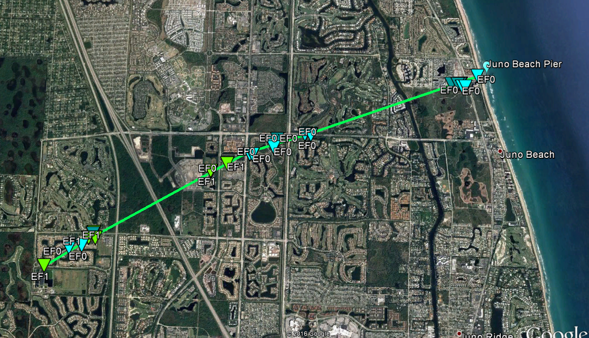
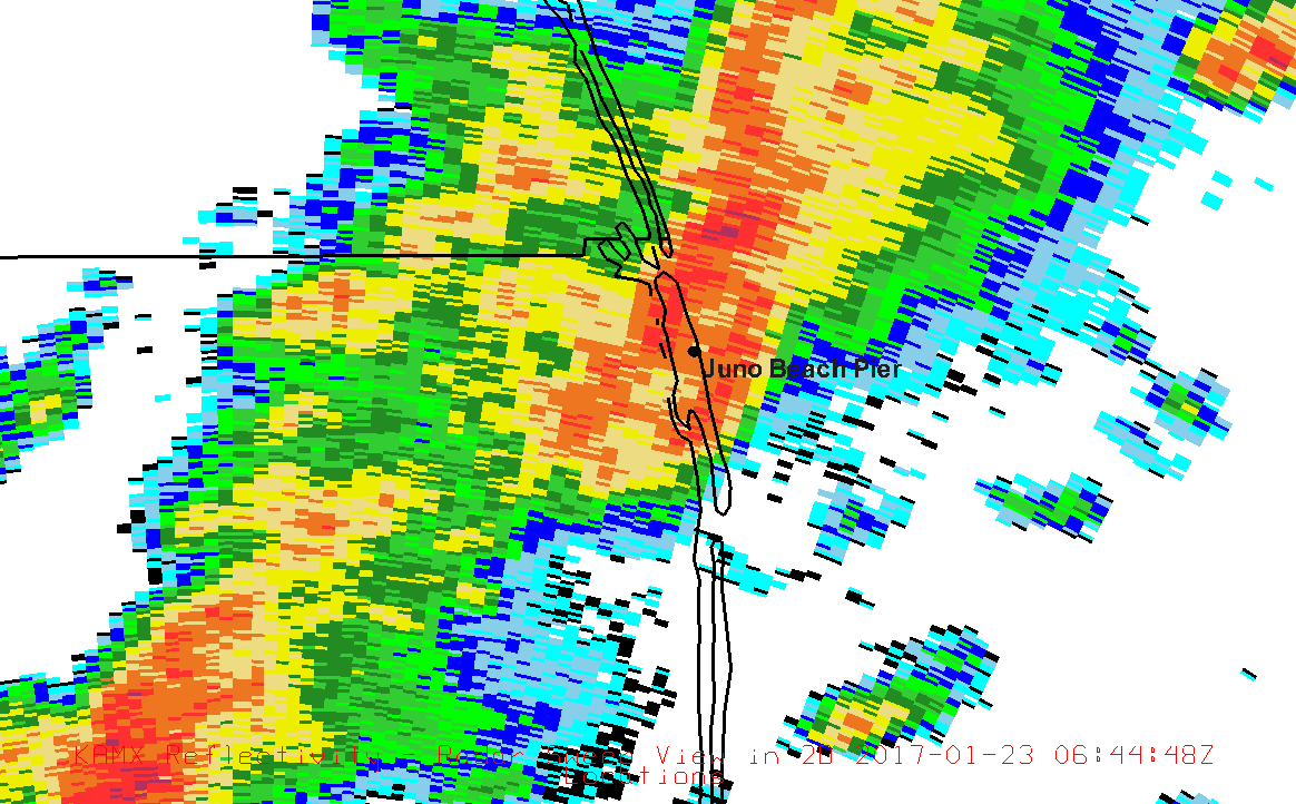
The above image also shows that as the tornado tracked offshore it also struck the Juno Beach Pier. Though it dislodged sections of the pier’s railing, WeatherFlow’s Juno Beach Pier weather station held strong and recorded weather conditions as the tornado passed overhead. Radar imagery clearly indicates the severe thunderstorm passing over the Juno Beach Pier and the Spectrum Width analysis is consistent with a tornado. (Note: High values of Spectrum Width indicate variability in movement, turbulence, or chaotic flow.)
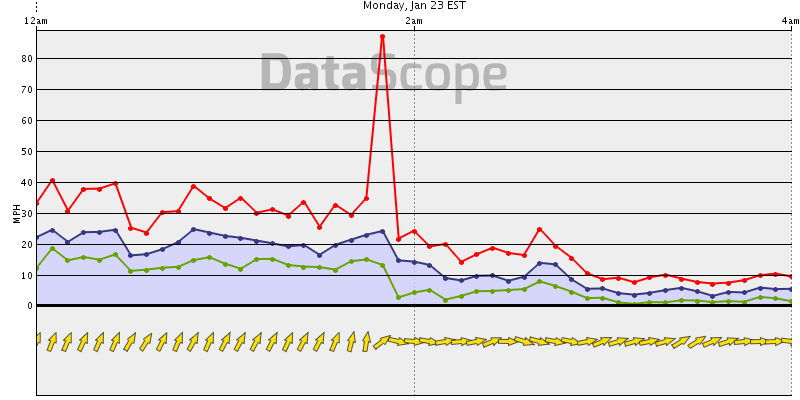
As the the tornado plowed through, WeatherFlow’s weather station at Juno Beach Pier provided a reliable continuous data feed. The peak gust (as shown below) was 87 mph at approximately 1:46AM.
For more information about WeatherFlow’s premium weather network or about WeatherFlow data, Contact Us.