
Poquoson, VA – WeatherFlow now brings a new observing capability to its suite of offerings by the recent addition of water level sensing. Microwave sensing allows for the monitoring of water level in a low-cost, highly reliable, and accurate manner.
WeatherFlow has chosen the same sensor that is used by the United States Geological Survey (USGS) in their gauge network. In 2014, WeatherFlow deployed a single unit adjacent to its’ office in Poquoson, VA at the entrance of the Wythe Creek watershed. Impressed with both the data collected and its reliability (data collection has been uninterrupted since the install date), WeatherFlow felt ready to add this capability as a natural add-on to meteorological station deployments within the littoral zone.
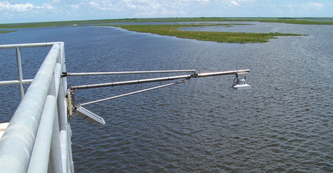
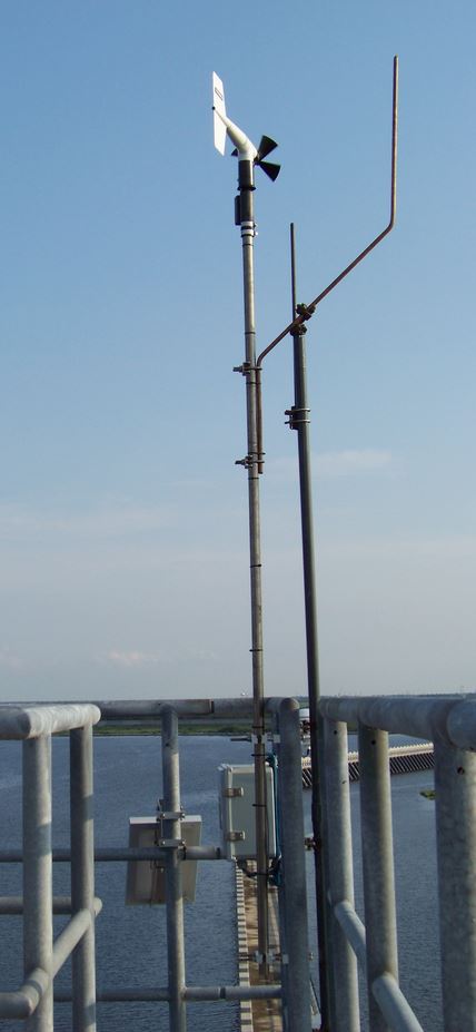 In 2016, WeatherFlow had multiple funded projects that called for the collection of both water level and meteorological data. For example, in July, WeatherFlow engineers deployed a unique monitoring system for the Southeast Louisiana Flood Protection Authority (SLFPA), which is home to one of the world’s largest flood control barriers. At the Bienvenue Flood Gate, at vital portion of the flood control barrier, WeatherFlow placed a much-needed meteorological station and two water level monitoring systems, one along the outer wall and another along the inner wall. (See images left and below.)
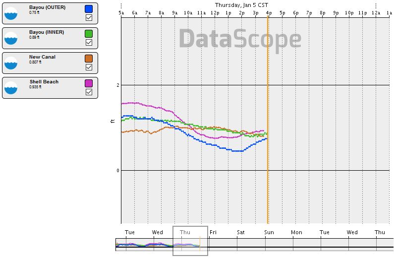
These observations allow the SLFPA to measure water level differentials across the barrier. Vital water level data like these enable authorities to better manage inundation-related threats in this vulnerable region.
In fact, these data have helped SLFPA in more ways than originally scoped. SLFPA is now using these data to learn more about, and hopefully forecast, currents along the inter-coastal waterway and other canals, bayous, and tributaries that dominate this marshy landscape.
The following time series graph depicts water levels for the two sensors installed at the Bayou Bienvenue gate along with two NOAA-NWLON sites, Shell Beach (about 10 miles to the east of the outer gate) and New Canal (about 8 miles to the west of the inner gate).
For more information about WeatherFlow’s water level sensing capabilities, Contact Us.